EXPLORE
Sunshine Coast, British Columbia
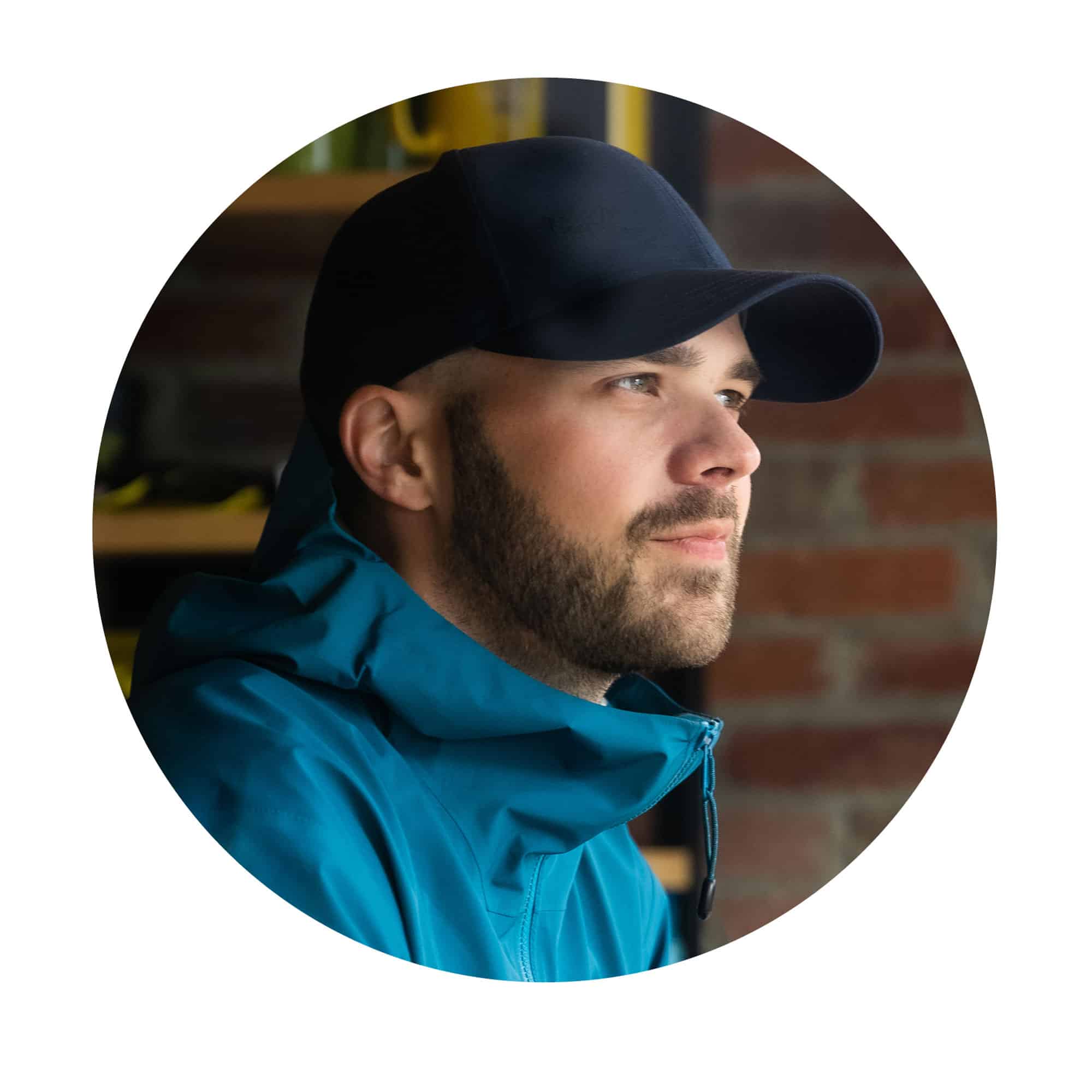
Life as a photographer takes Callum Snape all over the world. But, at home in Canada, there’s one place he keeps coming back to.
“One of the things I really like about the Sunshine Coast is the feeling that no one else is around. It’s just you and nature.”
CALLUM SNAPE, TRAVEL AND ADVENTURE PHOTOGRAPHER
“Keep an eye out for orcas,” says Callum Snape, as he focuses his camera on the waters of Howe Sound, his jacket zipped tight against the sharp morning wind. “There’s always a good chance you’ll see a pod of them, or a humpback whale, or a seal. You can always spot some sort of ocean life.”
It’s just after dawn and the Vancouver-based travel photographer is on the ferry from Horseshoe Bay to Langdale, the gateway to one of British Columbia’s most beautiful yet lesser-known drives: the Sunshine Coast. It’s a meandering route of around 180 km in all, tracing coastal curves and lakelands, weaving through old-growth forests, and dotted with fishing villages, artists’ studios and spectacular hiking trails.
“The Sunshine Coast is incredible because it’s so close to Vancouver,” Callum says. “You can just hop on this ferry and within the hour you’re out in the wilderness, completely disconnected from busy city life.”
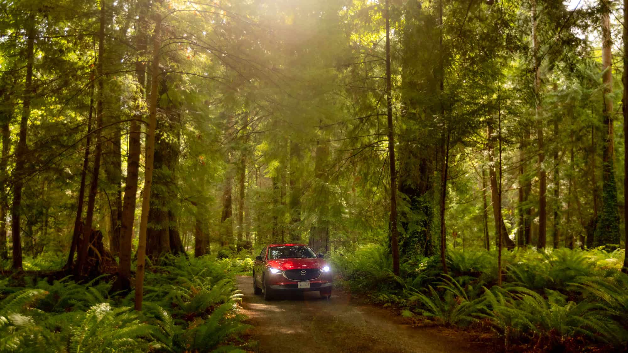
Callum has driven this route half a dozen times, yet when the ferry approaches the terminal at Langdale, he rushes to his Mazda CX‑30 Turbo, eager to get on the road. “I love driving and this route is truly special,” he says. “It’s so relaxing. It feels almost like I’m in a meditative state when I drive it, following the curves of the road, absorbing all these forest and sea views. There’s a sense of nostalgia for me, like remembering a family holiday. But it’s also exciting because the route is so diverse—you never know what’s coming around the next bend.” The CX‑30’s engine thrums into life and Callum drives down the ramp onto the harbourside. “Are you ready?” he grins as he pulls onto the Sunshine Coast Highway. “Let’s go.”
The Sunshine Coast Highway | Two-hour drive | 110 km | Google Map
Follow Callum’s step-by-step guide for your own adventure on the Sunshine Coast Highway. Beginning in Vancouver, board the ferry from Horseshoe Bay to Langdale and then depart southwest to Gibsons. From there it’s a 25-minute drive to Sechelt, which is the last built-up area of the Sunshine Coast drive. Continue northwest and follow the coast past Halfmoon Bay and turn left on Brooks Road to reach Smuggler Cove Marine Provincial Park. Then head north and take a detour to Pender Hill, before rejoining the highway to reach the tiny fishing village of Egmont.


Gibsons to Sechelt
Head southwest from Langdale and within 10 minutes you’ll arrive at Gibsons—a small harbourfront town known for its great oysters, and fish and chip restaurants along the pier. My first stop is always Beachcomber Coffee, to pick up a great-quality coffee or iced latte and kickstart my return to the Sunshine Coast.
You don’t have to drive far out of Gibsons to realize there’s something special about this part of British Columbia. On the side of the road, you’ll begin to see signs marking artists’ workshops—everything from potters to painters to jewellery-makers. It’s a tight-knit creative community in this region, and many artists use wood, stone and other resources from the surrounding area.
Around 25 minutes’ drive northwest along the coast is the town of Sechelt. Here you’ll find Artie George at Coast Raven Design Studio. He’s an indigenous sculptor from the Tsleil-Waututh Nation who has been carving for 36 years, creating beautiful artworks from native cedar and yellow pine.

Sechelt to Smuggler Cove
Sechelt means “land between two waters” in the indigenous language. It’s a one-kilometre strip of land where the Sechelt Inlet meets the ocean, and it’s the last built-up area on the Sunshine Coast drive. As you continue northwest, the buildings become sparser and nature takes charge. The scenery rears up into old-growth forests, and the view over the coast reveals the rocky, low-lying Trail Islands to your left.
Follow the coast past the pretty harbour village of Halfmoon Bay and take a left on Brooks Road to reach Smuggler Cove Marine Provincial Park. Here is one of the area’s best hikes, an easy four-kilometre round trip through a beautiful, surreal landscape. It begins with a giant yellow cedar forest, then a flooded area where the cedar has leached into the water, creating the most amazing fresh scent in the air. Follow the wooden boardwalk through several lake areas until you reach the rocky point of Smuggler Cove.
This cove got its name from its shady past as a bolthole for rum-runners during the US Prohibition era, but it’s a fantastic place to relax, enjoy the views over the rocky inlet and listen to the waves crashing on the shore.


Smuggler Cove to Pender Hill
Head north on the Sunshine Coast Highway towards Madeira Park. This is where the road goes from great to incredible. It winds through the hilly landscape and meanders in bends and curves that you can fly around—it’s so much fun to drive. Between Madeira Park and Garden Bay, you drive by islands, inlets and Gunboat Bay, all shrouded in eerie mist.
Take a left on Garden Bay Road and follow it to reach the Pender Hill trailhead. Get your boots on and follow the trail for a steep 30-minute hike with the most incredible payoff. It ends in a clearing, and suddenly you’re above the tree line. The view opens up, revealing a stunning vista of lakes, hills thick with forest, a breathtaking archipelagos and the ocean.
The Sunshine Coast is a challenging one for a photographer because nature rules here. There isn’t always access to the places you’d like to go, and it’s hard to get above the tree line to see over the landscape. To get the best shots in this part of the world, you have to work for it—and when you do, it’s all the more rewarding.
A great place to break your journey overnight is the Pender Harbour Resort, where you can stay right by the water, have a barbecue on the shore and rent a kayak to explore the surrounding coastline.


Pender Hill to Egmont
Rejoin the Sunshine Coast Highway, which swoops inland for a curving ride through the peninsula’s forested interior before tracing the vast Ruby Lake with its beautifully clear blue-green waters.
The further you go, the greener the landscape becomes. Everything from tree trunks to the cabin roofs are covered in green lichen, creating a magical atmosphere. After the lake, take a right onto Egmont Road and follow the signs to Egmont, a tiny fishing village where you can take small boat tours and grab a delicious meal on the marina.
This area attracts some of British Columbia’s hardiest kayakers as the access point for the Skookumchuck Narrows is only a short drive away. Twice a day, the tide surges into the Sechelt Inlet through this narrow strait, creating one of the biggest tidal rapids in the world. The water boils up and forms a series of waves. One glance is enough to tell that, if you were to fall in or capsize, there’s a good chance you’re not going to get out of there easily—yet that doesn’t stop the skilled kayakers. Getting in the water is definitely not for the uninitiated, but you can take a seat on the natural rock platform and watch the experts tackle the surging rapids.
It’s a fitting place to end a journey up the Sunshine Coast—where the views over the water and forest are astounding, the air is crisp and scented with pine and ocean salt, and the busy modern world seems a million miles away.


Joy of driving
Canada’s best drives
Discover more fantastic drives in Canada


